
Join multiple village map and FMB sheets into one.
Two or more FMB sketches or cadastral sheets. Several survey, Khasra, Gat or Dag numbers and their subdivisions. Every sheet of a village, Mouza or Gaav Nakasha, even sheets from two neighbouring villages. Drag them together, let smart snapping line up each shared boundary, and export one print-ready map. Works with land-record sheets from every Indian state, and your files never leave your device.
What you can join
However many sheets it takes
There is no limit on the number of sheets, and they don't have to come from the same survey number, or the same village.
Multiple FMB sketches
Join two or more FMB sketches along their shared boundaries into one continuous sketch.
Multiple survey numbers
A holding spread over several survey numbers becomes one map that shows its full extent.
Multiple subdivisions
Bring every subdivision sheet of a split survey number back together into the parent parcel.
Multiple village map sheets
Assemble all the sheets of a large village map, and place two adjoining villages side by side.
Ratings & reviews from real map joins
Combined four village map sheets on my phone in minutes
The editor worked perfectly on my phone. I uploaded the four adjacent survey sheets (S1, S2, S3, S4), aligned the edges where they meet, and exported a single print-ready map in minutes — no office visit and no surveyor needed. Best of all, the sheets stayed private on my phone the whole time. Simple, fast and accurate.
Joined my own FMB sheets in the editor — nothing to install
I downloaded my village map and FMB sketches and used the in-browser editor to join them myself. I just dragged each sheet onto the canvas and nudged the pieces with the arrow keys until the boundary lines lined up exactly. There was no software to install, and the maps never left my device. One payment covered the whole thing, and the export came out clean and sharp. Brilliant tool!
Got my combined FMB from home — no office visits needed
VillageMapJoiner made joining my land's FMB sketches really easy — I got the combined map from home without running to any office. When I asked for the old FMB, they clearly guided me that it's available at the District Collector office. Good service.
Incredible service for peace of mind!
I used this website to get a Joined FMB map, and the entire experience was seamless and fast. By combining individual sketches into one continuous view, it clearly illustrates how my property lines interact with adjacent plots. Having this definitive, highly accurate map leaves zero room for arguments and completely eliminates the risk of boundary disputes with neighbors. It is a fantastic platform that saves a lot of hassle—highly recommended!
Two ways to get your map
Do it yourself, or let us do it for you
Join the sheets yourself
Already downloaded your survey sheets from the government portal? Open the editor, drag them together, and smart snapping lines up every shared boundary. A flat ₹199 opens the editor for 24 hours: any number of sheets, unlimited full-resolution downloads, no subscription.
We source & stitch it for you
Don't want the government-website hassle? Tell us your land details and we download the sheets and join them: an FMB Sketch from ₹199 on WhatsApp, or a Combined Village Map for ₹1699 as a print-ready PDF in 1–4 hours.
Request a sketchPreview
Your whole village on one canvas
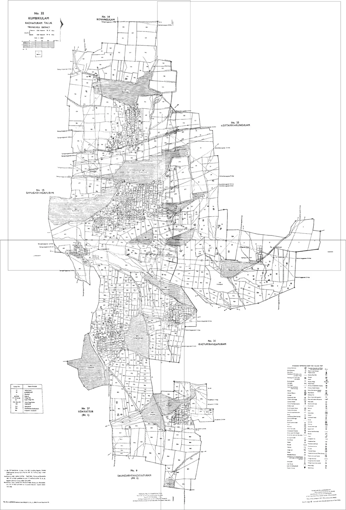
Smart alignment
Sheets that snap into place
Adjacent survey sheets meet like jigsaw pieces along their shared boundary. Village Map Joiner removes the friction: you make the call, snapping does the precision.
Video
Watch how it works
Everything you need to merge maps
100% private
No uploads, no servers. PDFs are processed entirely on your device.
Smart snapping
Edge-snap guides and filename auto-arrange line up sheets in a single click.
Clean seams
Auto frame-crop and white-to-transparent stop neighbouring sheets from overlapping.
High-res export
Export one continuous map as a PNG or print-ready A0–A4 PDF.
Don't want to do it yourself?
FMB Sketch from ₹199 · Combined Village Map ₹1699
No hassle with the government website: we download the sheets for you. Pick a service, pay online, and we deliver: an FMB sketch straight to your WhatsApp, or a combined village map as a print-ready PDF in 1–4 hours. FMB pricing starts at ₹199 and rises with the number of survey numbers you need joined.
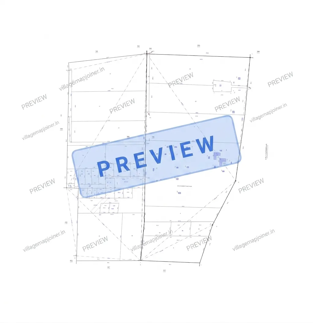
Order an FMB Sketch or Combined FMB Sketch
Tell us your land details and pay ₹199: we source the FMB sketch and send it straight to your WhatsApp.
No hassle with the government website: we download the sheets for you and send them over.
Across India
Pick your state
Every state and union territory has its own page, in its own land-record language: Tippan and RTC in Karnataka, Gaav Nakasha and 7/12 in Maharashtra, Mouza map and Dag number in Assam, Khesra and Jamabandi in Bihar, Killa and Fard in Punjab. The editor joins multiple sheets, parcels and villages the same way everywhere.
Tamil Nadu
Editor + we source and join the sheets for you
EditorAssam
Mouza map · Dharitree (ILRMS)
EditorKarnataka
village map / Tippan · Bhoomi
EditorKerala
village map / FMB sketch · e-Rekha / Ente Bhoomi
EditorTelangana
village / cadastral map · Dharani / Bhu Bharathi
EditorMaharashtra
Gaav Nakasha (village map) · MahaBhulekh
EditorAndhra Pradesh
village map / FMB sketch · Meebhoomi
EditorUttar Pradesh
Bhu-Naksha (village map) · UP Bhulekh
EditorOdisha
Bhu-Naksha (cadastral map) · Bhulekh Odisha
EditorDelhi
Shajra / village map · Delhi Land Records (DLRC)
EditorMadhya Pradesh
Bhu-Naksha (village map) · MP Bhulekh
EditorGujarat
village map / Block map · AnyROR
EditorBihar
Bhu-Naksha (cadastral map) · Bihar Bhumi
EditorWest Bengal
Mouza map · Banglarbhumi
EditorRajasthan
Bhu-Naksha (village map) · Apna Khata
EditorHaryana
Musavi / Shajra (village map) · Jamabandi Haryana
EditorPunjab
Shajra / Musavi (village map) · Punjab Land Records (PLRS)
EditorUttarakhand
Bhu-Naksha (village map) · Bhulekh Uttarakhand
EditorChhattisgarh
Bhu-Naksha (village map) · Bhuiyan
EditorJharkhand
Bhu-Naksha (cadastral map) · Jharbhoomi
EditorPuducherry
FMB sketch / village map · Puducherry land-records office
EditorJammu and Kashmir
Shajra / Musavi · Aapki Zameen Aapki Nigrani
Every other state & union territory
The editor works with any state's cadastral, village, Mouza or FMB sheets. Open your state for its own terms, portal and FAQ.
Land-record terms in every Indian state
The same document goes by a different name in every state: an FMB sketch in Tamil Nadu is a Tippan in Karnataka, a Gaav Nakasha in Maharashtra, a Mouza map in Assam and West Bengal, a Bhu-Naksha across the Hindi belt. This is what each state calls its map, its parcel and its record of rights, and where the sheets come from.
| State / UT | Village / cadastral map | Parcel number | Record of rights | Land-records portal |
|---|---|---|---|---|
| Andaman and Nicobar Islands | village / cadastral sketch | Survey number | RoR / Patta | Andaman and Nicobar Islands land-records office |
| Andhra Pradesh | village map / FMB sketch | Survey number | Adangal / 1-B (ROR) | Meebhoomi |
| Arunachal Pradesh | village / plot sketch | Plot number | Land Possession Certificate (LPC) | Arunachal Pradesh land-records office |
| Assam | Mouza map | Dag number | Chitha / Jamabandi | Dharitree (ILRMS) |
| Bihar | Bhu-Naksha (cadastral map) | Khesra number | Jamabandi / Khatiyan | Bihar Bhumi · Bihar Bhu-Naksha |
| Chandigarh | Shajra / sector plan | Khasra / plot number | Jamabandi / Fard | Chandigarh land-records office |
| Chhattisgarh | Bhu-Naksha (village map) | Khasra number | B-1 / P-II (RoR) | Bhuiyan · Bhu-Naksha Chhattisgarh |
| Dadra and Nagar Haveli and Daman and Diu | village map / Block map | Survey / Block number | 7/12 utara | Dadra and Nagar Haveli and Daman and Diu land-records office |
| Delhi | Shajra / village map | Khasra number | Khatauni / Jamabandi | Delhi Land Records (DLRC) |
| Goa | Survey plan (cadastral map) | Survey number & Subdivision | Form I & XIV | Directorate of Settlement & Land Records |
| Gujarat | village map / Block map | Survey / Block number | 7/12 utara (RoR) | AnyROR · iORA (Integrated Online Revenue Applications) |
| Haryana | Musavi / Shajra (village map) | Killa / Khasra number | Jamabandi (Nakal / Fard) | Jamabandi Haryana |
| Himachal Pradesh | Tatima / Shajra (village map) | Khasra number | Jamabandi | HimBhoomi |
| Jammu and Kashmir | Shajra / Musavi | Khasra number | Jamabandi / Fard | Aapki Zameen Aapki Nigrani |
| Jharkhand | Bhu-Naksha (cadastral map) | Khesra (plot) number | Panji-II / Khatiyan | Jharbhoomi |
| Karnataka | village map / Tippan | Survey number | RTC (Pahani) | Bhoomi · Dishaank / Bhu-Naksha |
| Kerala | village map / FMB sketch | Survey / Re-survey number | Thandaper | e-Rekha / Ente Bhoomi |
| Ladakh | Shajra / cadastral map | Khasra number | Jamabandi / Fard | Ladakh land-records office |
| Lakshadweep | island / plot sketch | Survey number | Land record extract | Lakshadweep land-records office |
| Madhya Pradesh | Bhu-Naksha (village map) | Khasra number | Khatauni / B-1 | MP Bhulekh |
| Maharashtra | Gaav Nakasha (village map) | Survey / Gat number | 7/12 (Satbara) | MahaBhulekh · Maha Bhu-Naksha |
| Manipur | cadastral map | Dag / Patta number | Jamabandi / Patta | Louchapathap |
| Meghalaya | village / locality sketch | Plot number | Land holding certificate / clan record | Meghalaya land-records office |
| Mizoram | plot / settlement sketch | LSC plot number | Land Settlement Certificate (LSC) | Mizoram land-records office · e-Ram (Land Revenue & Settlement Department) |
| Nagaland | village / plot sketch | Plot number | Land holding certificate / village record | Nagaland land-records office |
| Odisha | Bhu-Naksha (cadastral map) | Plot (Khata) number | RoR (Record of Rights) | Bhulekh Odisha · Bhu-Naksha Odisha |
| Puducherry | FMB sketch / village map | Survey number | Patta / Chitta | Puducherry land-records office |
| Punjab | Shajra / Musavi (village map) | Khasra / Khewat number | Fard Jamabandi | Punjab Land Records (PLRS) |
| Rajasthan | Bhu-Naksha (village map) | Khasra number | Jamabandi (Nakal) | Apna Khata · Bhu-Naksha Rajasthan |
| Sikkim | cadastral map | Plot number | Parcha Khatiyan | Sikkim Land Revenue & Disaster Management Department |
| Tamil Nadu | FMB sketch / village map | Survey number | Patta / Chitta | TN Survey & Settlement e-services |
| Telangana | village / cadastral map | Survey number | Sethwar / Pahani-Adangal | Dharani / Bhu Bharathi |
| Tripura | Mouza map | Plot (Dag) number | Khatian | Jami Tripura |
| Uttar Pradesh | Bhu-Naksha (village map) | Gata / Khasra number | Khatauni (RoR) | UP Bhulekh · UP Bhu-Naksha |
| Uttarakhand | Bhu-Naksha (village map) | Khasra number | Khatauni | Bhulekh Uttarakhand |
| West Bengal | Mouza map | Dag (plot) number | Porcha / Khatian (RoR) | Banglarbhumi |
Portals are named where the state runs an established one; elsewhere the sheets come from the district land-records office. Several north-eastern states hold land under customary or community tenure and have no state-wide cadastral series.
Tamil Nadu only
Your boundaries as coordinates, not just as paper
We turn FMB and village map boundaries into a KML layer you can open in Google Earth, in QGIS, or in a GPS app while standing on the land — and we plot revenue village and local-body maps at a real scale from the same data. Tamil Nadu only, because the Tamil Nilam GI viewer these are traced from covers one state.
FMB / village map → KML
Your boundary, as a KML
Give us the survey numbers or the village and we trace the boundaries into a layer that opens anywhere.
- A .kml you can open in Google Earth, QGIS, or any GPS app on the phone in your pocket
- Every boundary closed and labelled — village, survey number, or both, in English and Tamil
- Stands on the land: walk the line and watch your position sit on it
- Sent on WhatsApp and by email, yours to keep and to share with your surveyor
Priced by how much boundary there is — one village, a firka, a whole taluk. Tell us the area and we’ll reply with the number before anything is charged.
Revenue village map
A whole taluk, boundary by boundary
Revenue villages with municipality and town-panchayat limits over them, as a print sheet and as a KML.
- Revenue village boundaries for your taluk, traced from the Tamil Nilam GI viewer
- Municipality, town panchayat and village panchayat limits drawn over them
- A print-ready sheet at a real scale (the Tiruchendur sample below is 1:8,500)
- The same boundaries as a KML, so the sheet and the layer always agree
Priced by how much boundary there is — one village, a firka, a whole taluk. Tell us the area and we’ll reply with the number before anything is charged.
Sample: Tiruchendur taluk — 18 revenue villages, 4 local bodies
Generated from the KML we delivered, simplified for the web. Tap to open it full size.
Recent work
Maps we joined in Tamil Nadu
Real orders, joined sheet by sheet from the government’s own survey sheets and sent back as one continuous, print-ready map. Tap any of them to open it full size and read the survey numbers for yourself.
Reviews
Trusted across India 🇮🇳
Rated 5.0 out of 5 from 4 verified reviews
Ratings and written reviews together — landowners, farmers, surveyors and property buyers who joined their FMB sketches, village map sheets and Bhu-Naksha plots into one continuous map.
Combined four village map sheets on my phone in minutes
The editor worked perfectly on my phone. I uploaded the four adjacent survey sheets (S1, S2, S3, S4), aligned the edges where they meet, and exported a single print-ready map in minutes — no office visit and no surveyor needed. Best of all, the sheets stayed private on my phone the whole time. Simple, fast and accurate.
Joined my own FMB sheets in the editor — nothing to install
I downloaded my village map and FMB sketches and used the in-browser editor to join them myself. I just dragged each sheet onto the canvas and nudged the pieces with the arrow keys until the boundary lines lined up exactly. There was no software to install, and the maps never left my device. One payment covered the whole thing, and the export came out clean and sharp. Brilliant tool!
Got my combined FMB from home — no office visits needed
VillageMapJoiner made joining my land's FMB sketches really easy — I got the combined map from home without running to any office. When I asked for the old FMB, they clearly guided me that it's available at the District Collector office. Good service.
Incredible service for peace of mind!
I used this website to get a Joined FMB map, and the entire experience was seamless and fast. By combining individual sketches into one continuous view, it clearly illustrates how my property lines interact with adjacent plots. Having this definitive, highly accurate map leaves zero room for arguments and completely eliminates the risk of boundary disputes with neighbors. It is a fantastic platform that saves a lot of hassle—highly recommended!
From the blog
What you can download online vs. what needs an office visit
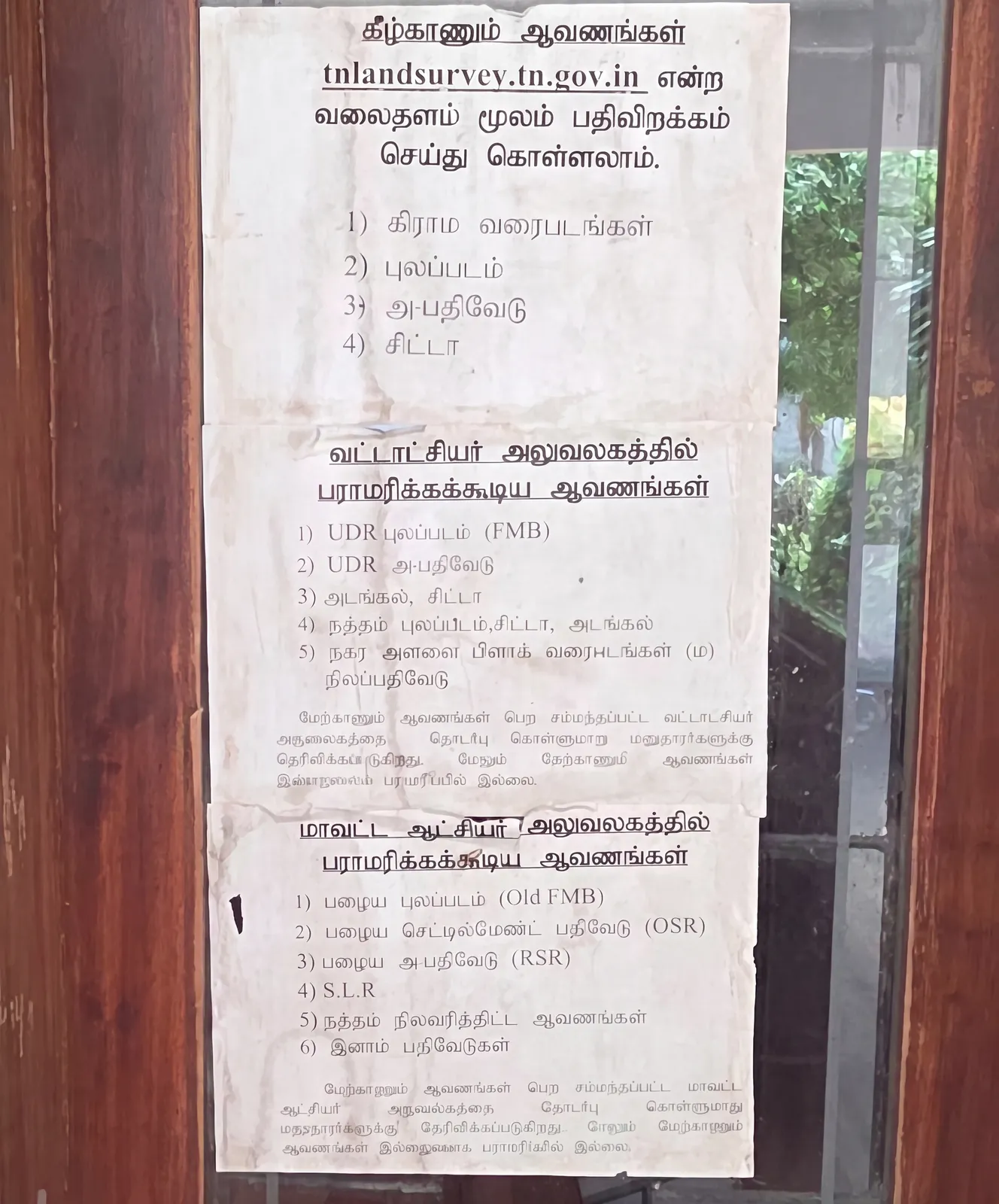
Tamil Nadu Land Records Online: What You Can Download and What Still Needs an Office Visit
A clear breakdown of which Tamil Nadu land documents you can download from tnlandsurvey.tn.gov.in (village maps, FMB, chitta, A-Register) and which ones (UDR FMB, Old FMB, OSR, RSR, inam registers) you can only get from the Taluk or District Collector office.
Read the guide →Pricing
Self-service₹199 flat · 24 hours of full editor access
- ✓Pay once up front, then upload, arrange & download with nothing held back
- ✓Any number of sheets joined: the price never changes
- ✓24 hours of full access · no subscription, no account
One flat rate however you use it: join 2 sheets or 20, it stays ₹199.
ℹ️ Only if you already have your map sheets downloaded from the government portal.
one-time: any number of sheets, same price
🔒 Paid up front through Razorpay. The payment screen has a walkthrough video, so you can see exactly what the editor does before you spend anything.
FAQ
Questions people ask before they start
- What does Village Map Joiner do?
- It joins the separate, adjacent sheets of a village survey map (Indian cadastral / FMB / mouza sheets, such as the S1, S2, S3, S4 files you download from a state land-records portal) into one continuous, high-resolution map. It renders the PDFs at print resolution, crops the printed frame, makes the white background transparent and snaps shared boundaries together so the sheets line up like jigsaw pieces.
- Can I join more than two sheets, several survey numbers or two villages?
- Yes, and that is the common case. There is no limit on the number of sheets: join two or more FMB sketches, several survey numbers, every subdivision sheet of a split survey number, all the sheets of a large village map, or sheets from two adjoining villages. They all go onto one canvas and export as a single continuous map, and the price does not change with the number of sheets.
- How much does it cost?
- Using the editor costs a flat one-time ₹199, paid before you start, through Razorpay (UPI, card or net banking). That opens the editor for 24 hours and covers everything inside it: any number of sheets, unlimited edits and unlimited full-resolution downloads. There is no subscription and no account. A walkthrough video on the payment screen shows exactly what the editor does before you pay, and the done-for-you services are priced separately.
- Does the price change with the number of sheets?
- No. Editor access is a flat rate: ₹199 for any number of sheets joined. The one payment covers the whole 24-hour window, so you can keep adjusting, start a fresh map and download again as often as you need without paying twice.
- Why do I have to pay before I can use the editor?
- The editor used to be free to work in, with a charge only when you downloaded the finished file. Most people assembled their map and screenshotted the screen instead of downloading it, which leaves them with a poor-quality copy and leaves a one-person tool unpaid. Charging ₹199 for access instead keeps it running, and in return there is nothing held back inside: no watermark, no blurred preview, and unlimited full-resolution downloads for 24 hours. Watch the video on the payment screen first to see exactly what you get.
- I paid but the editor didn't open. What do I do?
- Don't pay a second time. Access is remembered in the browser you paid from for 24 hours, so switching phone or browser, or paying inside WhatsApp and coming back in Chrome, can land you on the payment screen with your payment already made. On that screen, tap "Already paid and being asked again? Restore your access" and enter the mobile number you paid from, or the Razorpay payment id from your receipt. If the payment was in the last 24 hours you get the rest of that time back immediately. If it still doesn't come back, message the developer on WhatsApp at +91 80561 89086 or email aj.gb8056@gmail.com with the payment id and it will be restored or refunded the same day.
- Are my survey sheets uploaded to a server?
- No. The editor runs entirely in your browser: the PDF rendering, cropping and joining all happen on your own device. Your survey sheets are never uploaded and never stored on a server.
- Which states does it work for?
- Every one. All 28 states and 8 union territories have their own page in that state's own land-record vocabulary: FMB sketch and Patta/Chitta in Tamil Nadu, Tippan and RTC in Karnataka, Gaav Nakasha and 7/12 in Maharashtra, Mouza map and Dag number in Assam and West Bengal, Bhu-Naksha and Khasra/Khesra with Jamabandi or Khatauni across the Hindi-speaking states, Shajra and Fard in Punjab and Haryana, Survey plan and Form I & XIV in Goa. The editor itself is state-agnostic: it joins adjacent cadastral sheets whatever they are called. Sourcing the sheets for you, the done-for-you service, is Tamil Nadu only; everywhere else you download the sheets yourself and join them in the editor.
- What file formats can I upload and export?
- Upload the PDF sheets exactly as the government portal gives them to you (each page becomes one piece), or image files. Export the finished map as a single high-resolution PNG, or as a print-ready PDF fitted to A0, A1, A2, A3 or A4 with a live print-DPI estimate.
- Can you join the sheets for me instead?
- Yes. If you would rather skip the government portal entirely, the done-for-you Combined FMB Sketch service starts at ₹199 (priced by how many survey numbers we source and join) and is delivered to your WhatsApp; a whole-village Combined Village Map is ₹1699 as a print-ready PDF, typically within 1–4 hours. Both cover all Tamil Nadu districts.
- Is the joined map an official land record?
- No. The app arranges and joins map images you already have; it does not issue, certify or replace official records. Official documents (FMB sketches, Patta/Chitta, A-Register and the like) come only from the government department.